
I was reading, some time back, through back copies of Chepstow Weekly Advertiser I had, and noted that W.H. Greene had published a couple of his poems – Checking this out in my copy of ‘Folklore and Dialect of The lower Wye Valley‘ by Ivor Waters, a Moss Rose Publication of 1982, I noted the story on pages 72-74.
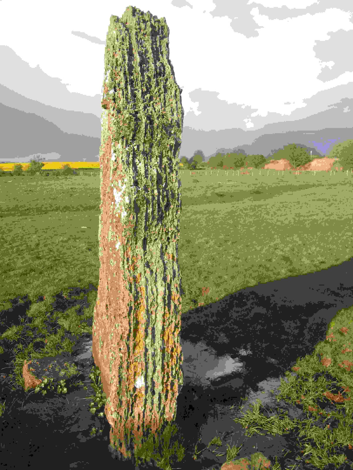
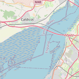
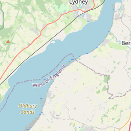
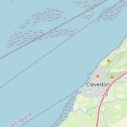
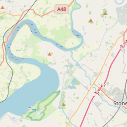
This is the story of a stone throwing competition between those old rivals Jack O’ Kent & The Devil, said to have taken place at Tidenham Chase and resulting in the Devil’s throw placing a standing stone, which menhir can be seen to this day rising some 9 feet in a field adjoining the old GWR line, still used, from Chepstow to Gloucester.
The stone stands in Stroat on the landward side some 50 feet from the railway line is rather unimaginatively known as The Wibdon Broad Stone though formerly it may well have been known as The Devil’s Quoit to judge by William Henry Greene’s poem.
It is strange that it has attracted the name Wibdon Broad Stone as it very clearly stands in Stroat on the land of Stroat Farm and at 50 inches in width it can hardly be considered ‘broad’ – It is thus more reasonable to call it The Stroat Standing Stone’ or perhaps ‘The Dolmen of Stroat’ or perhaps ‘The Stroat Menhir’!
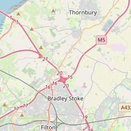
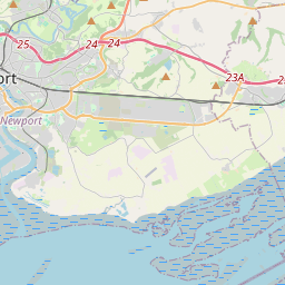
It is said that with a smaller stone Jack O’ Kent (might that be a popularisation to Kent of the title ‘Gwent’?) was thrown somewhat further landing near Thornbury on the South Bank of the River Severn.
You can read more of W.H. Greene born in Ross on Wye in 1832 who lived for some time in Chepstow and worked as a newspaper reporter for various titles in Monmouthshire – a profession his son followed in having been a reporter for The Chepstow Weekly Advertiser – W.H. Greene died in Newport on 31-Mar-1893.
For more about W.H. Greene CLICK HERE
When the weather improves I will try to remember to get some photos of The Stone and may also be able to track down The Thornbury stone via my cousin who has lived and worked in the Thornbury area all his life.
I have spoken with my cousin and he is trying to identify Jack O’ Kent’s stone near Thornbury.
I on the other hand set out to find The Stroat Standing Stone which I eventually found, almost directly between our house and The Severn standing isolated in a field, in fact nearer 50 yards than 50 feet from the rail line.
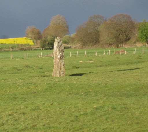
The Menhir stands some 97 inches high from the ground level to its tip.
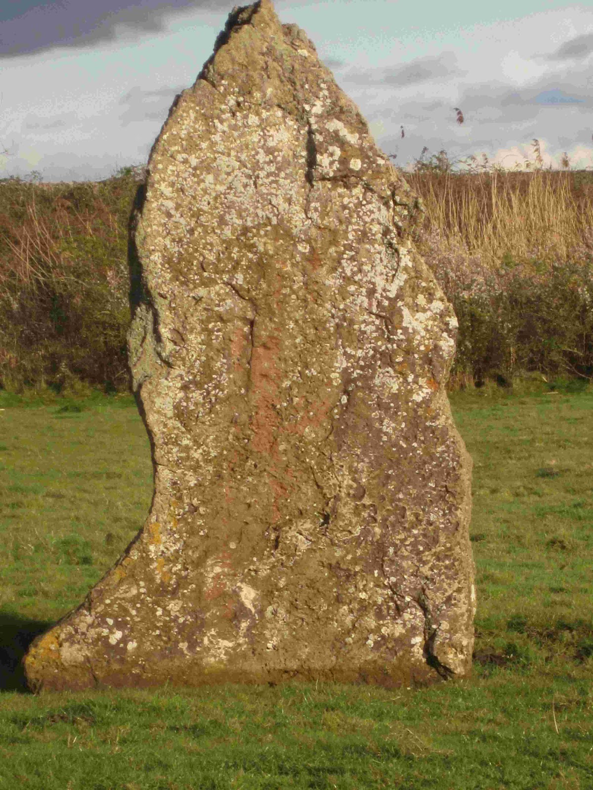
Though wider at the base the widest point higher up is about 50 inches.
This heavily statified menhir is 14 inches thick.
I have added the following material considerably later than the material above – as you can see, my thanks are due to the original authors, some identified, others using ‘Nom de Plume’ and yet others posting Anonymously.
My cousin Brian, who lived for many years in Hill and now lives in Thornbury probably knows ALL the individuals in this article and was for many years a member of Cristabelle’s local history group, which I gather, self terminated, as a result of the fraudulent folly of The Covid lockdowns.
Brian made a sound/informed guess as to whom the builder was/is & knew Mrs. Bruton whose knowledge is sadly long passed.
Brian has promised to let me know of any pertinent information he gleens.
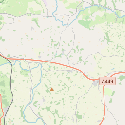
Oldbury Standing Stone – Standing Stone (Menhir) in England in Gloucestershire
Submitted by theCaptain on Thursday, 26 September 2019 Page Views: 6049
Neolithic and Bronze AgeSite Name: Oldbury Standing Stone
Country: England
County: Gloucestershire Type: Standing Stone (Menhir)
Nearest Town: Thornbury Nearest Village: Oldbury-on-Severn
Map Ref: ST61169234
Latitude: 51.628524N Longitude: 2.562514W
Condition: 2 Ambience: 3 Access: 4 Accuracy: 4

The Oldbury Standing Stone was thought to have been lost, if not destroyed, but investigations by christymko have uncovered this 11 foot long beauty. See comments for details.
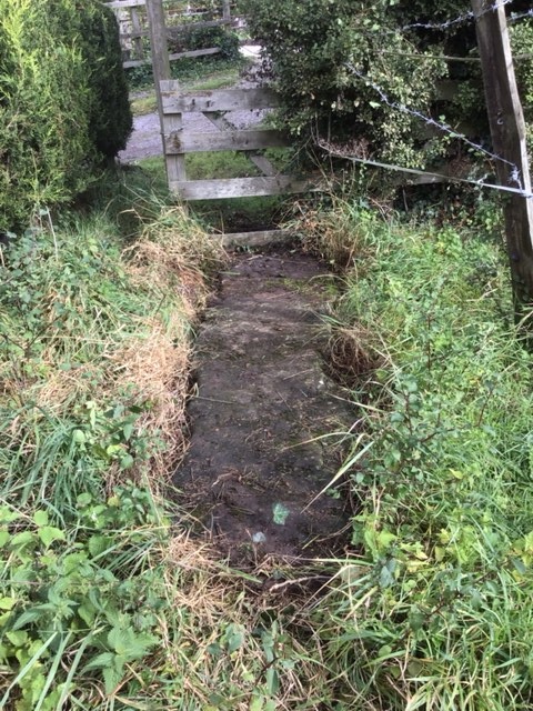
Position of a once 8ft tall standing stone, last recorded in 1953 as being used as a stone crossing of one of the tributary streams into the Oldbury Naite Rhine (pronounced Reen), to the east of the Anchor Pub.
So, on a warm sunny afternoon, I went for a good look, but found nothing to match the description. In fact, at some time in the past (since 1953) a whole load of drainage, seawall flood protection work has been done, which now contains the Oldbury Naite Rhine within substantial banks, with any of its little tributaries in the area now in underground culverts emptying through flap doors into the Rhine. The height of the banking is now well above what it would have been.
In a couple of places, away from the modern banks, it is possible to make out what might once have been tributary ditches, but these are now well hidden withn hedges, and all trackways have large new concrete bridges over anything that may get wet. Perhaps somewhere underneath it all is the old stone, or perhaps it has been broken up and now used at the edges of the roads to stop people parking on the verges. Certainly, I dont think there is anything left to be seen.
From Pastscape: ” ST 61169234. A large stone, formerly erect, 8 ft long, 1 ft broad and 2 ft thick, now lies across a small stream feeding Oldbury Naite Rhine.” (E K Tratman 14 11 1953)
Note: The Oldbury Standing Stone was thought to have been lost, if not destroyed, but investigations by christymko have uncovered this 11 foot long beauty. See comments for details.
You may be viewing yesterday’s version of this page. To see the most up to date information please register for a free account.
")

")
")
")
")
Click here to see more info for this site
To view the original of this article CLICK HERE
Nearby sites
![]() Click here to view sites on an interactive OS map
Click here to view sites on an interactive OS map
Key: Red: member’s photo, Blue: 3rd party photo, Yellow: other image, Green: no photo – please go there and take one, Grey: site destroyed

Download to GPS/SatNav (tap to view)
Turn off the page maps and other distractions
Nearby sites listing. In the following links * = Image available
365m N 350° The Toots (Oldbury)* Hillfort (ST611927)
541m SW 217° St Arilda’s, Oldbury-on-Severn* Artificial Mound (ST60839191)
2.1km SSE 163° St Arilds Well* Holy Well or Sacred Spring (ST61759030)
2.4km NNW 327° Oldbury-on-Severn Submerged Forest* Natural Stone / Erratic / Other Natural Feature (ST59849440)
4.0km S 185° Elberton Camp* Hillfort (ST60808840)
4.3km SSE 160° Alveston Round Barrow* Round Barrow(s) (ST62608831)
4.5km E 85° Camp Hill (Rockhampton)* Hillfort (ST657927)
4.7km ENE 72° Rockhampton Standing Stone* Marker Stone (ST65679378)
5.3km SE 133° Abbey Camp* Hillfort (ST65008870)
5.6km SSE 157° Fishmonger’s Swallet Cave or Rock Shelter (ST63318720)
5.7km S 188° Miles Well* Holy Well or Sacred Spring (ST6036486654)
6.0km NW 325° Broad Stone (Gloucestershire)* Standing Stone (Menhir) (ST5776397247)
6.1km S 182° Rams Well* Holy Well or Sacred Spring (ST6085186266)
6.3km NE 43° Blisbury Hill Camp* Hillfort (ST65569692)
6.6km SE 127° Tytherington Camp* Promontory Fort / Cliff Castle (ST66438834)
6.7km WSW 249° St Tecla’s Chapel & Holy Well Holy Well or Sacred Spring (ST5484390020)
7.2km W 265° Thornwell Round Barrow* Round Barrow(s) (ST540918)
7.2km W 264° Thornwell Farm* Chambered Tomb (ST53959167)
7.2km W 272° St Peter’s Cave Cave or Rock Shelter (ST539927)
7.4km W 273° The Bulwarks (Monmouthshire)* Hillfort (ST53789274)
7.8km E 96° Bloody Acre Camp* Hillfort (ST689915)
7.8km WNW 283° Chepstow Museum* Museum (ST53579420)
8.2km WNW 302° Spital Meend* Promontory Fort / Cliff Castle (ST54269671)
8.4km WNW 295° Pierce Wood Camp 1* Hillfort (ST53619596)
8.4km NW 311° Offa’s Dyke at Tidenham Chase* Misc. Earthwork (ST548979)
View more nearby sites and additional images
| “Oldbury Standing Stone” | Login/Create an Account | 5 News and Comments | ||
|
||
| Go back to top of page Comments are owned by the poster. We aren’t responsible for their content. |
| Re: Oldbury Standing Stone by stonetramp on Friday, 27 September 2019 (User Info | Send a Message) |
| Ah, now I see it in the comments. |
| [ Reply to This ] |
| Re: Oldbury Standing Stone by stonetramp on Friday, 27 September 2019 (User Info | Send a Message) |
| Wonderful that this stone was found, but why is there no story about how he found it? |
| [ Reply to This ] |
| Re: Oldbury Standing Stone by johndhunter on Friday, 27 September 2019 (User Info | Send a Message) |
| This is fascinating, is is known where it might have stood when erect , old OS maps don’t indicate any stones in the Priest’s Gout area, so it was probably already being used as a bridge before the first mapping took place. |
| [ Reply to This ] |
| Re: Oldbury Standing Stone by Anonymous on Wednesday, 25 September 2019 |
| Hi, I’m really excited to have randomly found your site as I know the location of the lost standing stone at Oldbury-on-Severn which I was really surprised to see mentioned. I was told many years ago by Mary Bruton, an eccentric and highly intelligent artistic lady who was born in Oldbury that it had been laid flat and used as a hard surface under the stile next to the bridge over the Rhine at Priest’s Gout. I edit the local community magazine ‘4ward’ and by chance there have been a couple of references lately to Priest’s Gout – the name of the old bridge over the Rhine so I before writing a little article about the stone I checked if it was still there and was amazed to see it just visible underneath debris under the old footpath gate ( recently replaced with a brand new kissing gate off to the side ) . Well , I mentioned this in the local pub last night and today a builder friend of mine went to take a look . He did more than look , he took dimensions – the stone is 11 feet long, 22 inches broad and 10 inches deep so quite a stone! The first thing my builder friend said was it looked like a bridge so I was fascinated to read on your site that it was in fact used as a bridge , probably for centuries. Could that have been its purpose all along ? |
| [ Reply to This ] |
IF YOU HAVE any information, stories or anecdotes of Stroat and its immediate environs please share them – do contact me and I will add them to the internet record – whether attributed or not is YOUR choice.
.
Details & Links: http://GregLanceWatkins.Blogspot.com
General Stuff: http://gl-w.blogspot.com
Health Blog.: http://GregLW.blogspot.com
TWITTER: Greg_LW .

